By Vlera Zymeri
Some places you don’t understand them from a distance, you understand them through return, repetition, and walking. Walking in the sense of not going somewhere, but as a way of seeing what is constantly changing.
Approaching Prishtina not as a place of residence, but as a place of observation and fieldwork. Encountering, through repeated visits, walking routes, and time spent reading it as an urban site rather than an everyday movement produced a specific kind of urban perspective, shaped by comparison, discontinuity, and attention to change rather than a familiar routine.
In this sense, the city becomes more than the capital of Kosovo. It becomes a condensed post-war and post-socialist urban case, where regional processes, political transformation, reconstruction, and privatization are spatially compressed and made visible at the street level. As argued by Henri Lefebvre, space is shaped through institutions, power relations, economic systems, and everyday practices.
The city itself is also a constructed system of spatial relationships between movement, built form, access, and perception. Prishtina sits at the intersection of these two frameworks, but they do not fully align. Walking is where that misalignment becomes visible.
Prishtina’s urban form reflects at least three dominant spatial regimes that coexist, overlap, and often contradict one another.
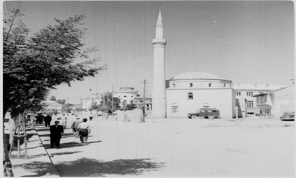
The first is the Ottoman city, structured around proximity, mixed-use development, and pedestrian-scale movement, where everyday life unfolded within a continuous and walkable urban fabric. This is evident in the city’s historic organization around the bazaar and mahalla system, where residential, commercial, and religious functions were tightly interwoven in a compact pedestrian environment. Ottoman urban structure also included key public infrastructure such as hammams (public baths), which developed across Kosovo during Ottoman rule. In the first two centuries alone, more than 15 hammams were built in present-day Kosovo, serving both residents and travelers as social and health spaces embedded within everyday movement.
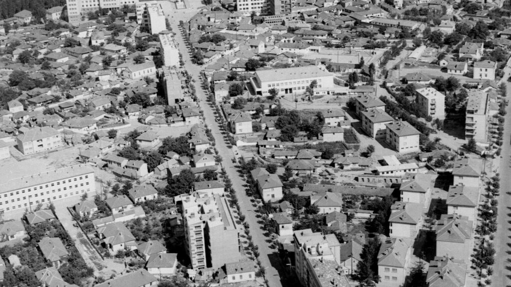
The second spatial regime is the socialist and modernist transformation of Prishtina in the post–World War II period, which fundamentally restructured how the city is walked and navigated. From a walkability perspective, this moment represents not continuity but rupture. Where earlier layers produced relatively legible pedestrian environments, the post-war city begins to erode the coherence of walking as a primary way of moving through and understanding urban space.
At the same time, socialist planning did not completely erase walking; it redefined it. New residential superblocks and housing estates were designed with internal pedestrian pathways, green courtyards, and semi-public communal spaces that structured everyday movement within the neighborhood scale. However, these internal walkable environments were often disconnected from the wider city, making walking more localized and fragmented rather than continuous.
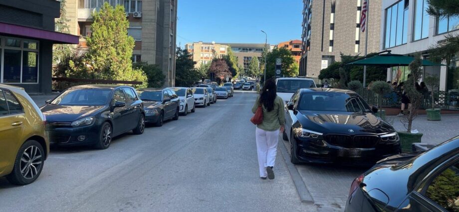
The third spatial regime of Prishtina unfolds in the post-1999 period, when the city enters a phase of rapid, uneven, and largely market-driven transformation. From the perspective of walkability, this moment represents not a continuation but a rupture in the city’s spatial logic. Where earlier layers had produced continuous pedestrian environments, the post-war city began to erode the coherence of walking as a primary way of moving through and understanding urban space.
Instead of the city growing in a way that naturally supports walking, like in the earlier Ottoman layout, where everything was close and reachable on foot, or the socialist period, where neighborhoods were structured around everyday pedestrian life, the city starts to lose that internal logic of movement. After the war, reconstruction did not follow a clear or shared plan. Growth happened quickly, but in fragments. Private investment, urgent economic needs, and weak planning rules began to shape urban form, and walking had to adapt to what was being built. After the war, reconstruction did not follow a clear or shared plan. Growth happened quickly, but in fragments. Private investment, urgent economic needs, and weak planning rules began to shape urban form, and walking had to adapt to what was being built.
The core issue is not the coexistence of these layers, but the absence of a connective system that integrates them. The city operates through overlapping spatial logics rather than a unified design framework. This becomes especially visible in walkability.
Walkability is not simply whether people walk. It refers to the design and accessibility of neighborhoods that support walking as a primary mode of transportation. It is whether walking is structurally supported as a primary way of experiencing the city. It is the quality of the pedestrian system: continuity, connectivity, safety, comfort, and legibility.
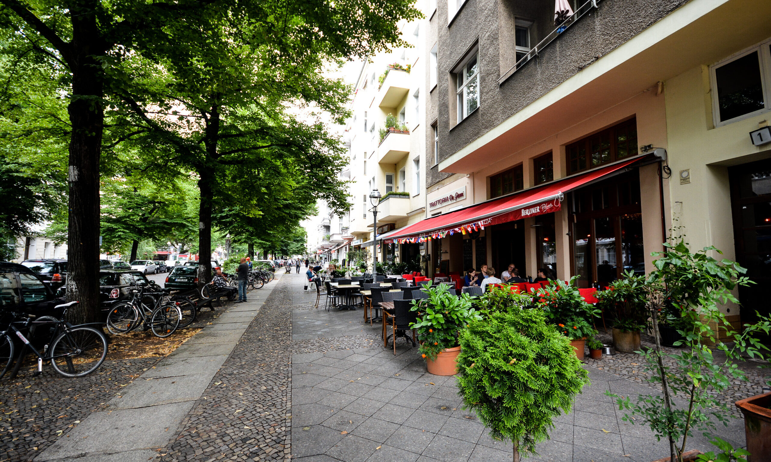
From a pedestrian perspective, walking often requires constant adjustments rather than a stable, continuous experience. It is broken into small decisions, where to step, how to bypass, when to leave the sidewalk, and re-enter it again. Movement is not fully carried by the city but reconstructed moment by moment through the body itself. In contrast to this fragmented experience, a city can be understood as one that should function as an extension of the body, where walking allows for pauses and transitions, shifts between shade and openness, and moments of compression and release.
When your attention is pulled downwards, towards the ground, instead of outward toward the city. You are not just moving, you are managing movement. This is where design, or the lack of it, becomes most apparent. Designing pedestrian space at its core is about reducing the constant need to manage. I notice it most in the way continuity is never fully stable. A walk rarely settles into a rhythm. Instead, it keeps restarting in small ways. A sidewalk should not suddenly disappear or change its logic every few meters. The material, width, and level should stay consistent enough that your body can relax into a rhythm.
Then comes the connection. Connection is something I only really notice when it is not there. There are points in the city where I find myself slowing down or stopping, not because I want to, but because the path no longer clearly continues. Comfort, too, is something I only begin to understand through its absence. I feel it in very physical ways, when there is no shade in the heat, when wind moves through open, unprotected streets, when there is nowhere to pause even briefly. A bench, a tree, they are not secondary; they are what make walking feel not like a chore.
Walkable cities rely on continuous, legible networks, sidewalks that don’t end, crossings that are safe and intuitive, and routes that feel direct rather than obstructed. Kevin Lynch described this as legibility: the ability of a city to be easily read and navigated. In a walkable environment, people should be able to form a mental map without effort. Landmarks, edges, paths, and nodes should align in a way that supports orientation rather than confusion. When these elements are inconsistent, instead of reading the city, you are constantly re-reading it. You rely less on recognition and more on adjustment.
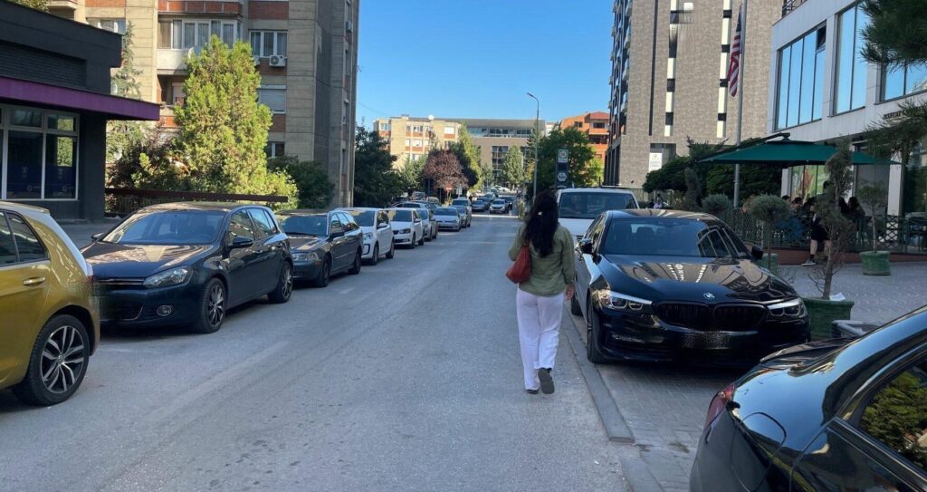
In many post-socialist and transforming cities, including Prishtina, walking often carries a different condition. It is not absent, but it is supported evenly. Some streets offer clarity while others break suddenly into parking lots, unfinished edges, or improvised transitions. A pedestrian network exists, but not always as a system. It is experienced more as fragments stitched together than as a continuous structure.
This difference is not only technical or infrastructural. It is experiential. It shapes how attention is distributed in the city. And over time, this changes how familiarity itself works. A street that should feel known begins to feel slightly unstable. Not entirely unfamiliar, but no longer fully reliable either. The sense of “knowing the route” is replaced by a sense of “remembering how to navigate it again.
This way, walking becomes a method of noticing urban change before it is formally visible. It reveals transformations that are too small to appear as planning narratives, but too frequent to ignore in lived experience: a narrowed sidewalk, a blocked passage, a newly fenced lot. Each one on its own is minor; together, they shape how the city is understood through movement.
So, the question of walkability is not only about mobility. It is also about perception, memory, and time. A walkable city does not just make movement easier. It allows the city to be read as something coherent, even as it changes. Perhaps this is where the reflection returns to its starting point.
Walking, in the end, is not only a way of moving through the city, but a way of staying in relation to it while it shifts. It is a practice of return that never finds the same city twice, but still tries to trace continuity within that change. The city does not remain still long enough to be fully known. But through walking, it can still be followed.

Vlera Zymeri holds a bachelor’s degree in Sociology from the University of Prishtina. She is a U.S. Department of State scholar through the CCI Program, where she studied Mass Communication at College of DuPage.